 |
|||
|
|
|||
|
|
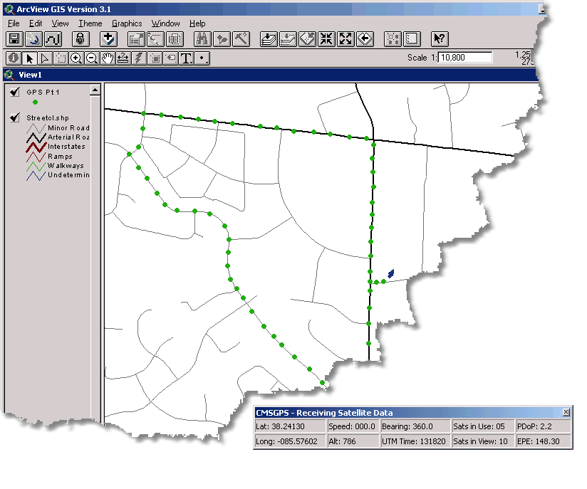
CMSGPS is a simple to use, low cost GPS tracking software that can be used with ArcView 3.X or ArcMap. The extension primarily tracks the current GPS position and shows this position graphically on the GIS. As your position moves, the screen will pan to keep your position visible. Users are able to record and log GPS positions to a shapefile. Raw NMEA output can be logged to a file and can even be played back by using the "Read From File" feature. The software provides a sophisticated display panel that can be used to: Display Speed, Number of Satellites, PDOP, GPS Time, and complete satellite position and strength information. Light weight (under 1 MB memory, 5 Mb disk), easy to use, and flexible best describe CMS's new GPS tracking and logging software. CMSGPS works with any NMEA streaming GPS device from low cost $100 dollar USB units to high end survey grade units. CMSGPS can be installed and running in a matter of minutes. Users can download a FREE 30 Day Evaluation Copy of CMSGPS. Users do NOT need a GPS unit to use the 30 day trial version as it can read NMEA data from a file.. CMSGPS was developed as a low cost solution for utility companies to provide truck maps in the field. Using a low cost GPS units, field crews can easily see the maps for the areas they are working on and can even record locations from repairs made.
 Here is a sampling of tasks that CMSGPS can be used for:
*(accuracy is determined by the GPS unit and quality of satellite reception)
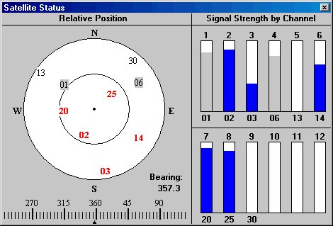
Users can easily view their relative position and the satellites in view with their signal strength.
System Requirements
Pricing
|